The Stream Pollution Trends Monitoring Program (SPoT) assesses sediment toxicity and contaminants from up to 100 diverse watersheds throughout California. Analysis has included toxicity testing with the amphipod Hyalella azteca and the midge Chironomus dilutus, as well as the measurement of current use pesticides, metals, polycyclic aromatic hydrocarbons, polychlorinated biphenyls, legacy pesticides, and emerging contaminants such as fipronil, per- and poly-fluoroalkyl substances (PFAS), and polybrominated diphenyl ethers (PBDEs) in watershed sediments. This extensive data set, started in 2008, has been analyzed in the context of watershed land use to understand the nature of identified water pollution and trends and provides current data to water resource managers. SPoT is part of the California State Water Resources Control Board’s Surface Water Monitoring Program (SWAMP).
A complete set of reports, fact sheets and other documents covering the first ten years of monitoring can be found here, and the first five years of data are summarized in Siegler et al. (2015). Reports include complete methodology. Below are the latest highlights from the program and updates from the latest trends in toxicology and contaminant concentrations.
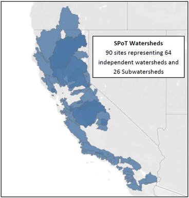
SPoT sites are located in large watersheds with heterogeneous land cover, at or near the base of the watershed. Darker areas on the map indicate sub-watersheds. Sediments collected from depositional areas provide a composite record of pollutants mobilized throughout the watershed. While many hydrologic, engineering, and environmental variables affect the ability of this record to adequately characterize all pollutant-related activities, sediment samples are a relatively robust and logistically feasible means for long-term trend assessments in large watersheds.
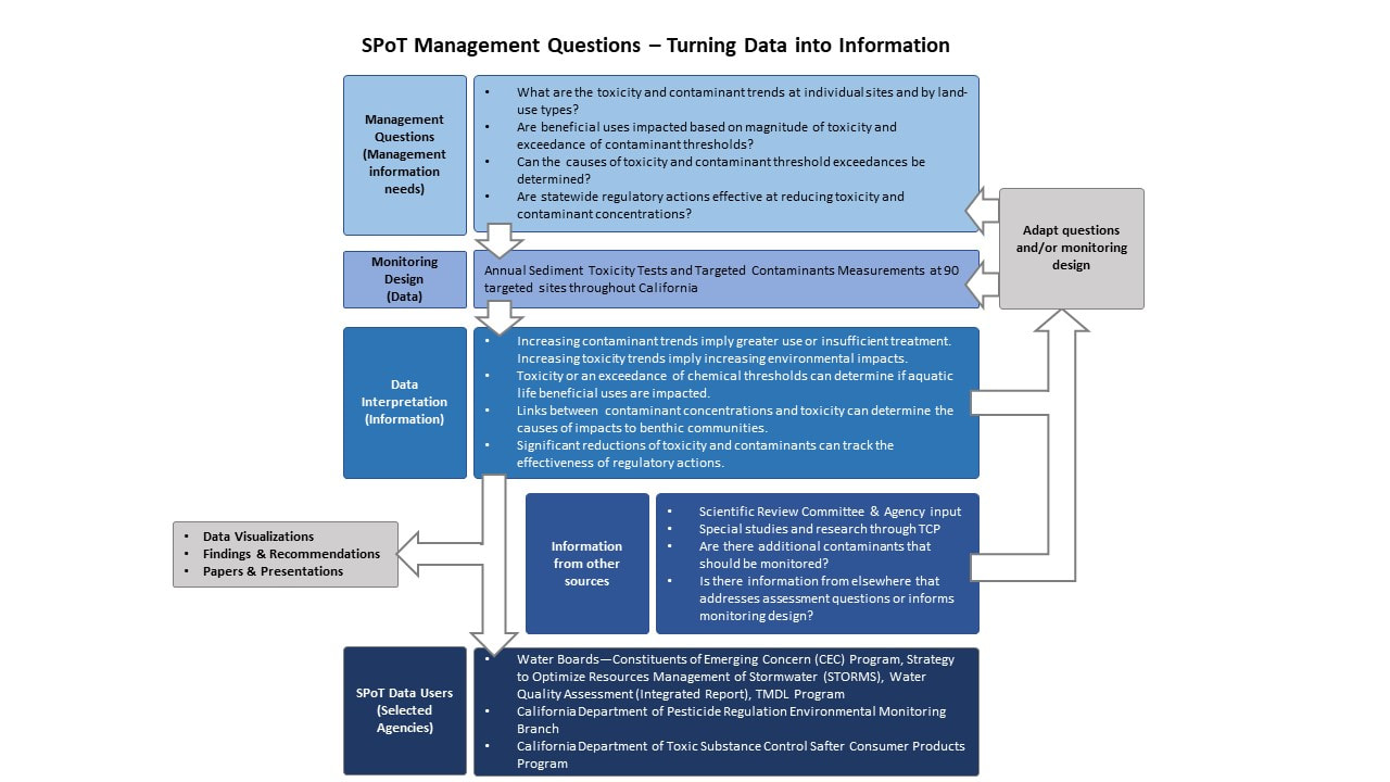
The SWAMP Assessment Framework provides guidance and context for developing question-driven monitoring to provide water quality information directly useful for resource management. These assessments pertain to aquatic life protections, and the water body types that are assessed include streams that range from ephemeral creeks to large rivers. SPoT-specific management questions are summarized in the graphic below.